More storms? Hereâs who may get the worst weather today
More potentially severe storms are in the forecast for Alabama on Tuesday.
The storms will be possible starting later this morning and could be a factor through the evening hours, according to the National Weather Service.
The strongest of those could have damaging winds, lightning and heavy rain.
Today south Alabama could be the focus of the most intense storms.
NOAA’s Storm Prediction Center has much of the southern half of the state in a Level 2 out of 5 risk for severe weather today.
A Level 2 risk means that scattered severe storms will be possible.
Extreme southwest Alabama and parts of north-central and north Alabama will have a Level 1 risk today, which means that isolated severe storms will be possible.
Much of north Alabama isn’t included in the severe weather outlook for a change.
However, that won’t be the case on Wednesday and Thursday, when the SPC has the potential for more storms in the forecast for Alabama.
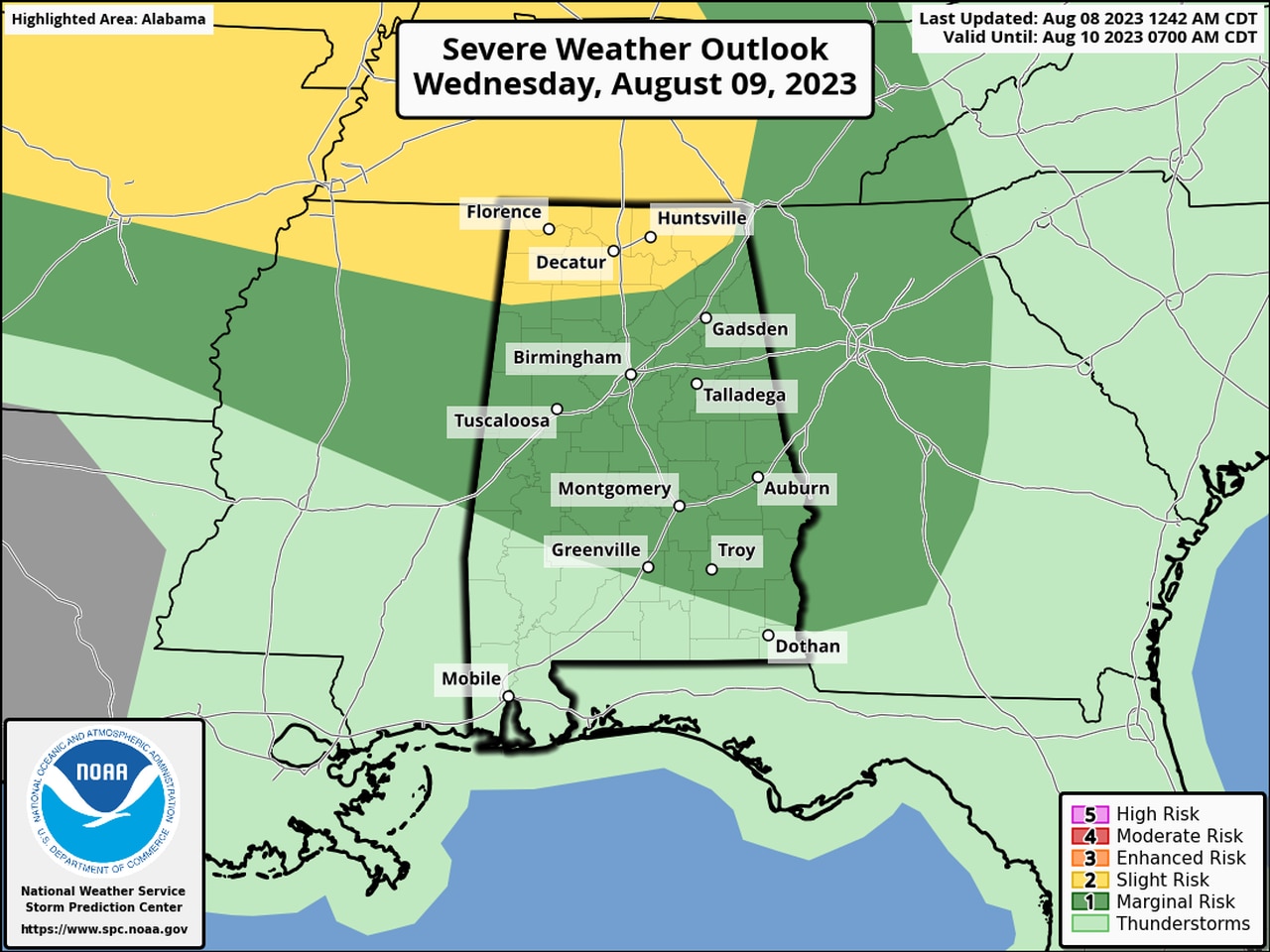
Here is the severe weather outlook for Wednesday, which has a Level 2 risk for much of north Alabama and a Level 1 risk for a large part of the rest of the state:
Here’s the severe weather outlook for Wednesday.
And here’s the forecast for Thursday, which has a Level 1 risk for much of north and north-central Alabama:
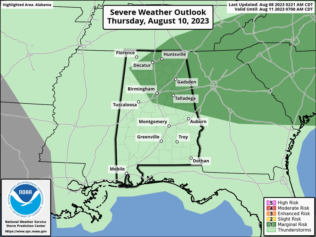
There will be a Level 1 severe weather risk on Thursday for north Alabama.
Storms this week will also have that same potential for damaging winds and heavy rain.
An unsettled pattern will stick around for the rest of the week.